🗺️ 地图投影:把圆球摊成平纸🗺️ Map Projection: Flattening a Ball onto Paper
上一片把海洋也逛完了,整颗蓝色星球都走过一遍。可地球是个圆球,地图是张平纸——怎么把球面搬到纸上?🌍 蓝色星球向导先剥了一个橘子。Last leaf finished the ocean tour — the whole blue planet, walked end to end. But Earth is a ball and a map is a flat sheet. How do you move one onto the other? 🌍 Blue Planet Guide starts by peeling an orange.
第 1 步:球面摊平,一定会破Step 1: Flatten a sphere and it must tear
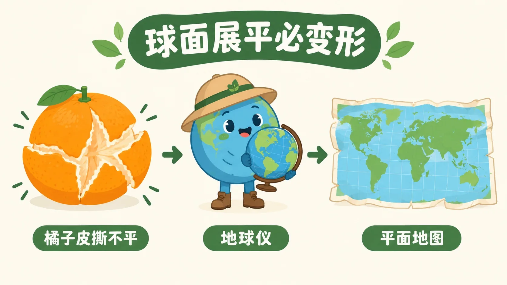
别急着看地图,先拿个橘子试一次。Before looking at any map, try it once with an orange.
把橘子皮完整剥下来,按在桌上压平——中间一定会裂,边上一定会翘。地球也一样:球面是「不可展曲面」,摊到纸上必然要撕、要拉、要挤。地图投影,就是把球面上每一个点搬到平纸上的那套规则。既然躲不开变形,问题就不再是「变不变」,而是「让它变在哪儿」。Peel an orange in one piece and press it flat on the table: the middle splits, the edges curl. A sphere is what mathematicians call non-developable — you cannot flatten it without tearing, stretching or squeezing. A map projection is simply the rule for moving every point of the globe onto flat paper. Since distortion is unavoidable, the real question is never whether a map distorts, but where you let it distort.
那有多少种「摊法」可以挑?So how many ways of flattening are there to choose from?
第 2 步:三种摊法——圆柱、圆锥、方位Step 2: Three ways to flatten — cylinder, cone, plane
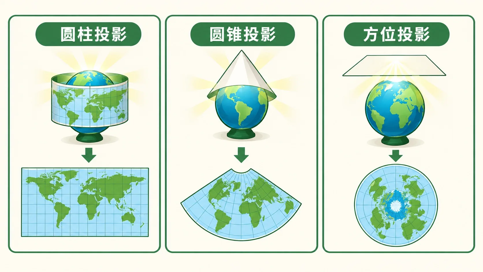
想象在地球中心点一盏灯,把影子投到一张纸上。纸卷成筒贴着赤道,叫圆柱投影,摊开是规整的长方形,世界地图最常用。纸卷成锥帽罩住中纬度,叫圆锥投影,摊开是扇形,画中国、美国这种中纬度大国最合身。纸直接平贴在极点,叫方位投影,摊开是圆盘,看北极航线一目了然。纸贴得越紧的地方越准,离得越远变形越大。Picture a lamp at the centre of the globe casting shadows onto a sheet of paper. Roll the paper into a tube around the equator and you get a cylindrical projection — it unrolls into a tidy rectangle, the classic world map. Shape it into a cone over the mid-latitudes and you get a conic projection — it unrolls into a fan, the best fit for wide mid-latitude countries. Lay the paper flat against a pole and you get an azimuthal projection — a disc, perfect for polar flight routes. Wherever the paper touches the globe the map is accurate; the further away, the worse the distortion.
「变形」听起来很轻,到底能夸张到什么地步?“Distortion” sounds mild — but how wild does it actually get?
第 3 步:代价——格陵兰被吹成了非洲Step 3: The price — Greenland puffed up to Africa's size
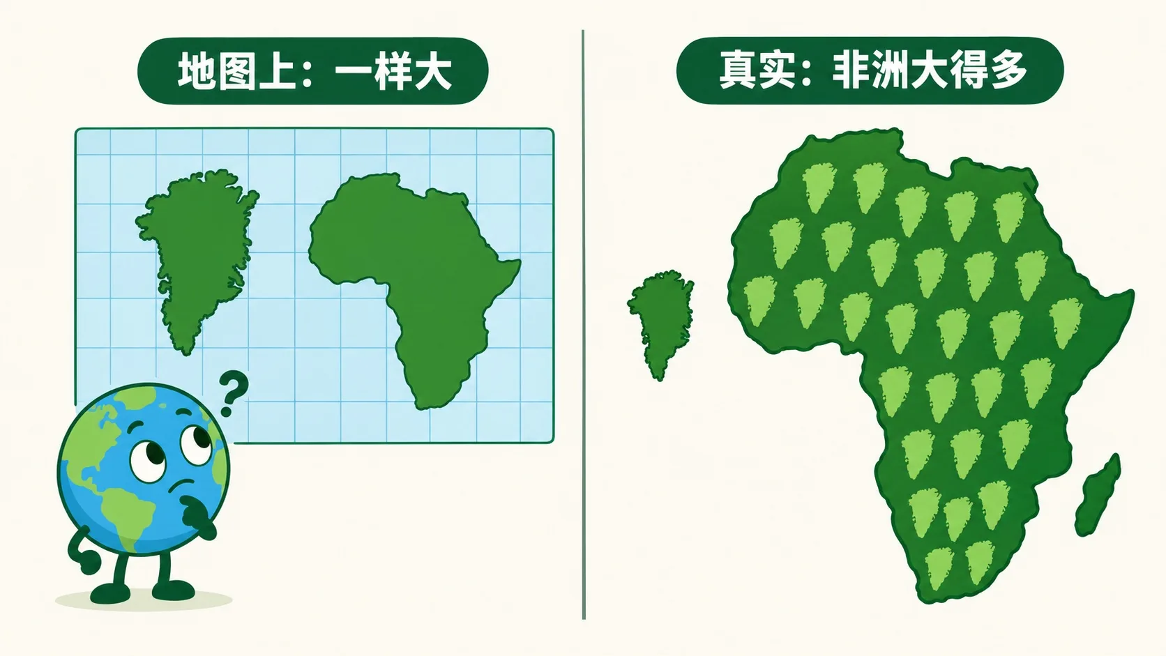
课本和手机上最常见的是墨卡托投影。它专门保住形状和方向:一直朝东北走,在图上就是一条直线,航海和导航全靠它。代价是面积越往两极越夸张——北纬 60° 放大 4 倍,北纬 80° 放大 33 倍。于是图上格陵兰看着和非洲差不多大,实际上非洲的面积是它的 14 倍。想公平比大小,得换等积投影(面积真、形状歪)。保形状还是保面积,只能二选一。The map in your textbook and on your phone is usually Mercator. It was built to preserve shape and direction: “keep sailing north-east” is a straight line on the sheet, which is why navigation still runs on it. The price is area — inflated 4× at 60° N and 33× at 80° N. So Greenland looks about the size of Africa, when Africa is really 14 times bigger. To compare sizes fairly you switch to an equal-area projection (true area, bent shapes). Shape or area: you get one, never both.
🎮 你来把地球摊平(30 秒)🎮 Your turn: flatten the globe (30 seconds)
四个按钮切换四种投影,看网格怎么扭——每个绿圈在真实地球上都一样大、一样圆。Four buttons, four projections; watch the grid morph — every green circle is the same size and shape on the real globe.
一句话记住它:地图投影是把球面搬到平纸的规则——面积和形状,只能保住一个。Remember it in one line: a map projection is the rule for moving a sphere onto flat paper — you can keep area or shape, never both.
球面不可展:所有地图都在变形,区别只是变在哪儿、变多少A sphere cannot be flattened: every map distorts — they differ only in where and how much三大类按贴纸方式分:圆柱(长方形)、圆锥(扇形)、方位(圆盘)Three families, by how the paper touches: cylindrical (rectangle), conic (fan), azimuthal (disc)墨卡托保形状方向、面积失真(80°N 放大 33 倍);比大小要用等积投影Mercator keeps shape and bearing but wrecks area (33× at 80° N); use an equal-area map to compare sizes
内容参考 OpenStax 等公开教材,多来源核对 · AI 生成、人工审核 · 发现错误欢迎指正,帮这片叶子长得更好。Based on OpenStax and other open textbooks, cross-checked across sources · AI-generated, human-reviewed · Spotted a mistake? Tell us — help this leaf grow.
 Back to tree