上一片里,我们跟着卫星在天上找路。从天上往下看,大地皱起一串长褶子——那就是山脉。🌍 星球向导带着小水滴落到地面,看这副骨架是怎么撑起来的。Last leaf, we found our way with satellites up in the sky. Look down from orbit and the ground wrinkles into long folds — those are mountain ranges. 🌍 the planet guide lands with Drip the water drop to see how this skeleton holds the land up.
第 1 步:山脉是怎么挤出来的Step 1: How ranges get squeezed up
山从不是一座孤峰,而是一整串。先看它们在哪儿,再看是谁把它们挤出来的。Mountains never stand alone — they come in long rows. First see where they are, then who squeezed them up.
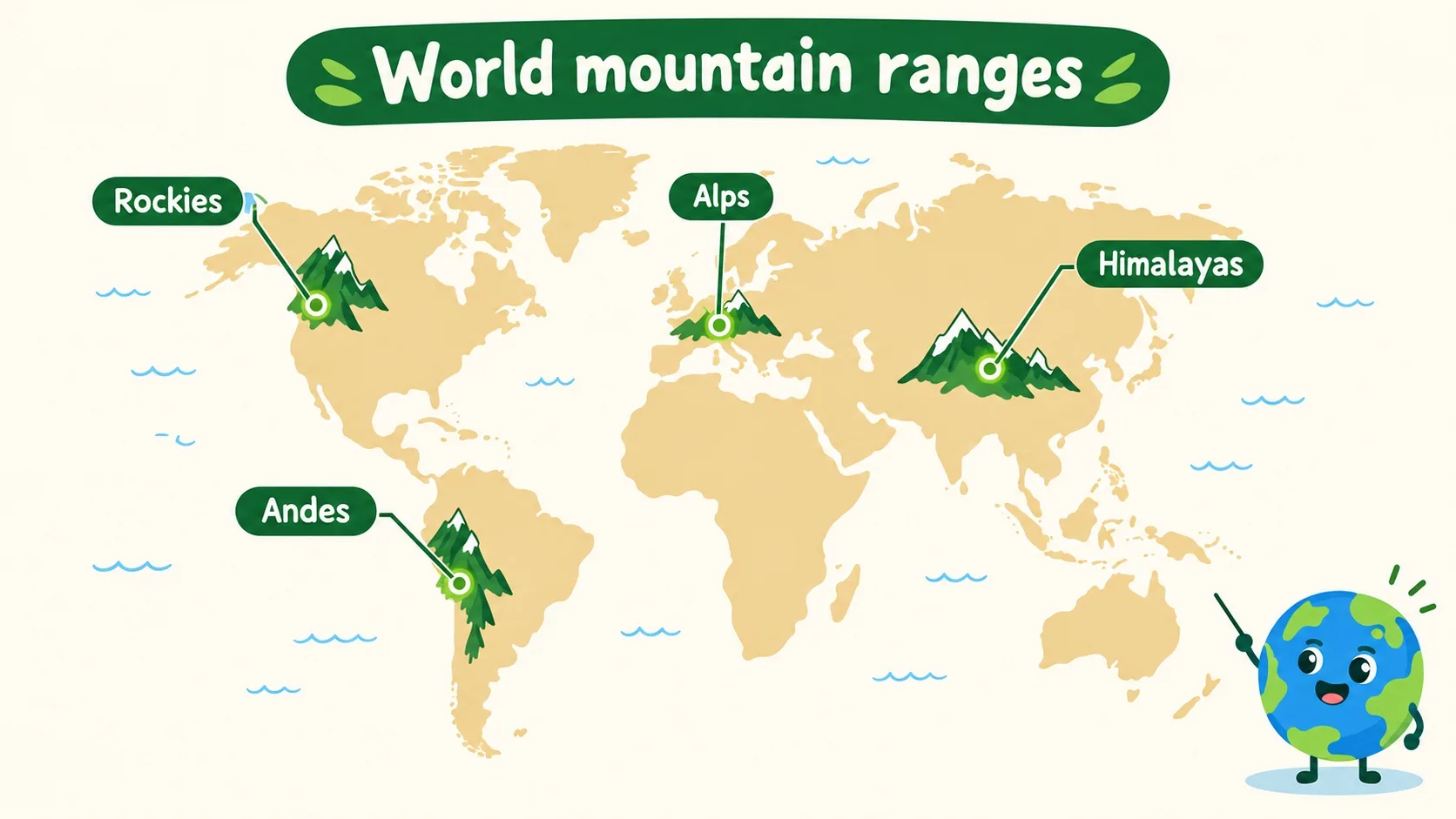
山脉就是连成串的山。板块互相挤压,地层皱成褶皱山(喜马拉雅还在每年长高)。岩浆喷出来,会堆成火山山。四大名山脉各就各位:亚洲喜马拉雅最高最年轻,南美安第斯最长,欧洲阿尔卑斯最出名,北美落基山最粗犷。A range is mountains in a row. Plates shove together and the crust wrinkles into fold mountains (the Himalayas still grow taller every year). Erupting magma piles up volcano mountains. The four famous ranges take their places: the Himalayas in Asia, tallest and youngest; the Andes in South America, longest of all; the Alps in Europe, most famous; the Rockies in North America, wildest.
最高的山有多高?人爬上去会怎样?How tall is the tallest? And what happens to people who climb it?
第 2 步:登上珠峰,喘不上气Step 2: Up Everest, out of breath
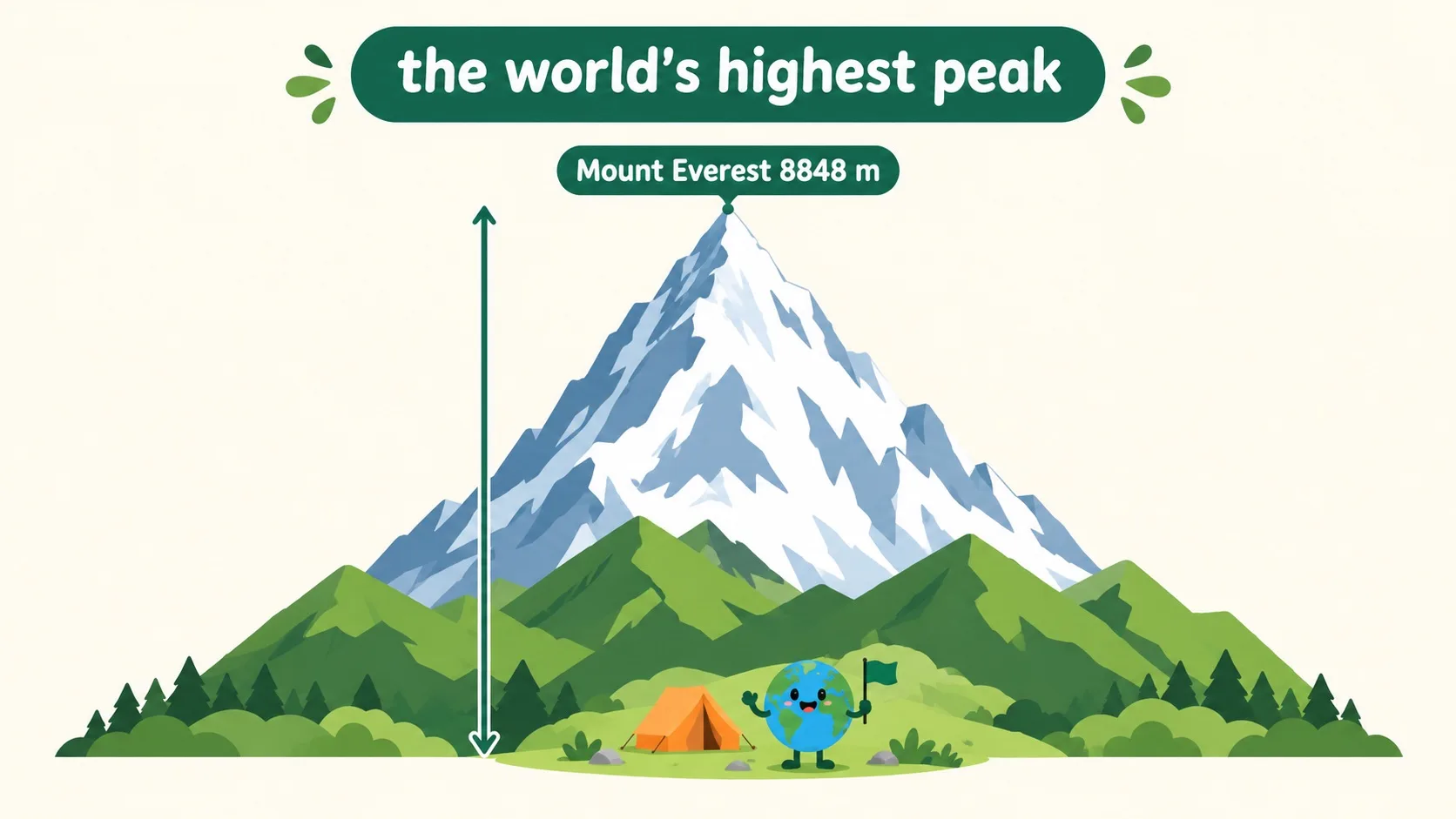
珠穆朗玛峰 8848 米,是世界最高峰。山顶空气只有山脚三分之一,氧气不够用,人会头疼、喘不上气,这叫高原反应。所以登山要一步步适应,慢慢让身体跟上。Mount Everest stands 8848 m, the world's highest peak. Its summit air is only a third as thick as at sea level. Starved of oxygen, people get headaches and gasp — altitude sickness. So climbers ascend step by step, giving their bodies time to catch up.
可山不只是高。同一座山,山脚和山顶像两个世界——为什么?But a mountain is more than tall. One mountain's foot and summit feel like two worlds — why?
第 3 步:一座山,叠起整条气候带Step 3: One mountain stacks every climate belt
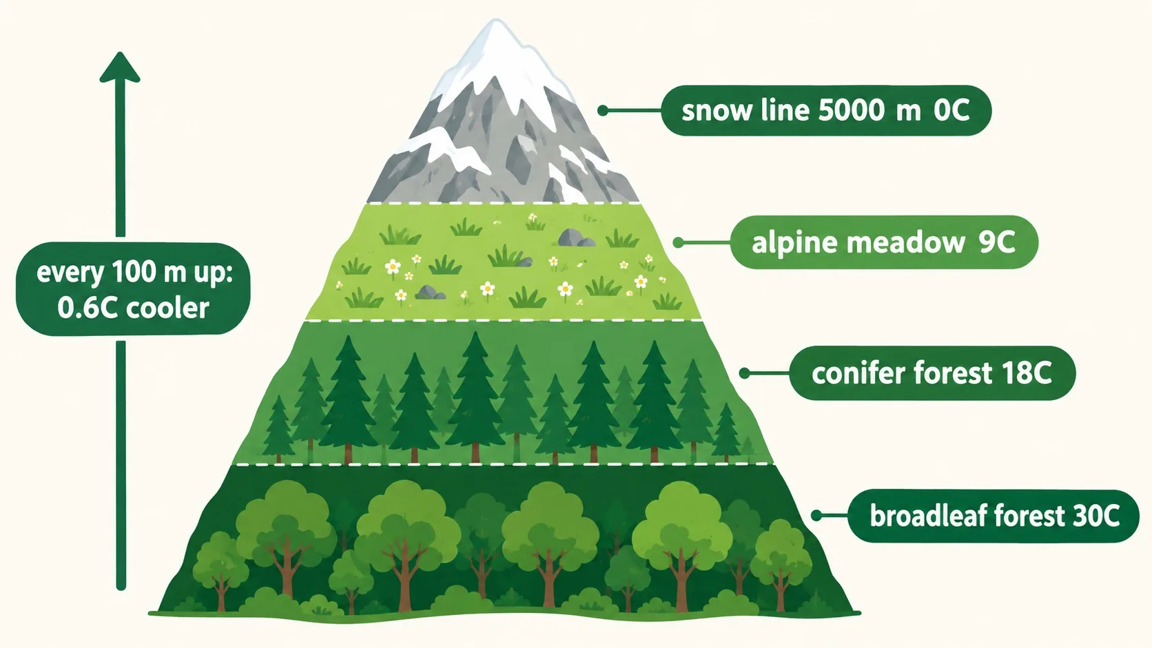
因为高度决定冷暖:每升高 100 米,气温降 0.6℃。山脚阔叶林闷热,往上变成针叶林,再往上只剩高山草甸,5000 米雪线以上终年积雪。从山脚走到山顶,等于从热带一路走到了寒带。Because height sets the temperature: every 100 m up, it drops 0.6℃. Muggy broadleaf forest at the foot gives way to conifer forest, then alpine meadow, then the snow line at 5000 m with year-round snow. Walking foot to summit equals walking from the tropics to the polar zone.
🎮 你来当登山向导(30 秒)🎮 Your turn: mountain guide (30 seconds)
道理讲完了。先拖滑块带小水滴爬上 6000 米,看气温和植物一层层换班;再接 4 张任务卡,把滑块停到对的那一层。Theory done. First drag the slider and take Drip up 6000 m, watching temperature fall and plants change shift; then take 4 task cards and park the slider in the right band.
一句话记住它:山脉是板块挤出的大地骨架;珠峰 8848 米是最高点;同一座山从山脚到山顶,叠起了整条气候带。Remember it in one line: ranges are the land's skeleton, squeezed up by plates; Everest at 8848 m is the highest point; one mountain stacks every climate belt from foot to summit.
山脉成因:板块碰撞挤出褶皱山,岩浆喷出火山山;喜马拉雅还在长高How ranges form: colliding plates wrinkle up fold mountains, magma piles up volcanoes; the Himalayas still grow高海拔:珠峰 8848 米,空气稀薄会高原反应,登山要逐步适应High altitude: Everest 8848 m, thin air brings altitude sickness, so acclimatize step by step垂直带:每升高 100 米降 0.6℃,山脚热带、山顶雪,雪线约 5000 米Vertical belts: 0.6℃ cooler per 100 m — tropical foot, snowy top, snow line near 5000 m
内容参考 OpenStax 等公开教材,多来源核对 · AI 生成、人工审核 · 发现错误欢迎指正,帮这片叶子长得更好。Based on OpenStax and other open textbooks, cross-checked across sources · AI-generated, human-reviewed · Spotted a mistake? Tell us — help this leaf grow.
 Back to tree